Natuition presents the now NavX, the portable GNSS RTK rover. |
|
|
|
|
 |
| 75 sec |
Do you need to locate irrigation lines, map equipment on a golf course, report damaged areas, or accurately recover the reference points of a football field after mechanical work?
NavX is a portable rover designed to make centimeter-level positioning simple and fast outdoors.
Thanks to its tri-band GNSS RTK technology, NavX delivers highly accurate positioning even in complex environments, with no subscription required.
 |
It can be used for surveying, field marking, mapping, and more. It is suitable for fieldmanagers, greenkeepers, and professionals who need a high-performance geolocation tool that is immediately ready for operational use.
The rover was designed for easy field use, with quick handling and straightforward integration into practical workflows. It is therefore well suited to professionals looking for a precise positioning tool without relying on systems that are too heavy or too complex to deploy on a daily basis.
In the golf sector, NavX can be used, for example, to locate irrigation lines, define the different areas of the course such as fairways, greens, and tee boxes, and identify specific zones or equipment such as holes, sprinklers, or site furniture. It can also be used to report incidents or field anomalies such as dry patches, damaged areas, or other points requiring targeted intervention.
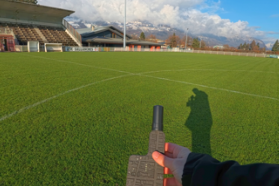
On a football field, the rover can be used to record precise reference points such as sprinklers, corners, goals, or even concrete plots to avoid during mechanical operations. These reference points can then be reused to accurately re-establish the field after an intervention, based on reliable markers that remain available over time.
Combined with its Compagnon NavX app, it makes it easy to carry out customized GNSS surveys according to the needs of your activity. The app helps users take full advantage of centimeter-level accuracy directly in the field, with an interface designed for operational uses such as field marking, layout, mapping, or structuring work areas. To adapt to different field configurations, NavX can also be used with several accessories, such as its surveying pole, a precision dome antenna, or a special backpack pole dedicated to mobile surveying.
Overall, NavX is a precision positioning tool designed for practical field applications, offering a strong balance between performance, ease of use, and adaptability to field conditions.
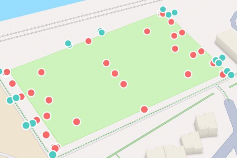 | | Example of a survey on a football field |
|
|
| Milati Grass Machines B.V... | |
| |
| LOG IN
with your email address to respond.
|
|
|
| There are no comments yet. |
|
| |
Anyone can place small ads for free through their own account.
Place a free ad
|
|
|
|


